The Role of the Astrolabe in Ancient Navigation in Nicaragua
Nicaragua, a land rich in history and culture, has long been a significant hub for maritime practices in Central America. As early as the pre-Columbian era, indigenous peoples developed sophisticated techniques for navigation that were closely tied to their understanding of the stars and the natural world. This deep connection to the sea not only facilitated trade and exploration but also shaped the social and cultural landscapes of the region. With the arrival of European explorers, new navigational tools and methods were introduced, marking a transformative period in the history of maritime navigation in Nicaragua.
Among the most remarkable of these navigational instruments was the astrolabe, an ancient device that revolutionized the way navigators charted their courses across the vast oceans. Understanding the intricacies of the astrolabe—its definition, functionality, and historical development—provides valuable insight into how it influenced navigation practices in Nicaragua. By examining the role of the astrolabe alongside local maritime traditions, we can appreciate its significance in the broader context of exploration and trade during this pivotal time.
This article delves into the profound impact of the astrolabe on ancient navigation techniques in Nicaragua, highlighting how celestial navigation methods were employed and showcasing case studies of its practical use in Nicaraguan waters. Through this exploration, we aim to uncover the contributions of the astrolabe not only to maritime navigation but also to the cultural and economic exchanges that have shaped Nicaragua's rich maritime heritage.
Historical Context of Navigation in Nicaragua
Nicaragua, a country rich in biodiversity and cultural heritage, has a profound history of navigation that dates back to pre-Columbian times. The strategic location between the Caribbean Sea and the Pacific Ocean has made it a significant hub for maritime activities. To understand the role of navigation in Nicaragua, it is essential to explore both pre-Columbian maritime practices and the influence of European exploration.
Pre-Columbian Maritime Practices
Before the arrival of Europeans, the indigenous peoples of Nicaragua exhibited remarkable ingenuity in their maritime practices. One of the primary groups, the Nicarao, utilized the region's extensive river systems and coastline for trade and transportation. With access to the Pacific Ocean, the Nicarao engaged in fishing and trade with neighboring tribes, establishing intricate networks that facilitated the exchange of goods and culture.
Evidence suggests that the Nicarao built canoes made from wood, which were sturdy enough to navigate the coastal waters and rivers. These vessels, often referred to as "piraguas," were designed for both fishing and transporting goods. The canoes were crafted using traditional methods, where artisans would hollow out a single tree trunk, resulting in a lightweight yet robust craft suited for the region's marine environment.
Maritime practices extended beyond mere transportation; they were deeply intertwined with the cultural and spiritual lives of these communities. The sea was perceived as a source of sustenance, and rituals were often conducted to honor the deities associated with water and navigation. The indigenous navigators relied on celestial bodies, such as the sun, moon, and stars, for navigation, showcasing an early understanding of astronomy that would later be pivotal in the development of navigation tools like the astrolabe.
The indigenous knowledge of navigation included an understanding of wind patterns, currents, and seasonal changes, which were vital for successful maritime travel. This knowledge was passed down through generations, emphasizing the importance of oral traditions in preserving navigational skills and practices.
The Influence of European Exploration
The arrival of Europeans in the early 16th century marked a significant turning point in the history of navigation in Nicaragua. Spanish explorers, drawn by the promise of riches and the desire to expand their empires, began to chart the waters of Nicaragua. Figures such as Christopher Columbus and Francisco Hernández de Córdoba played crucial roles in this exploration, which led to the establishment of new trade routes and the introduction of European maritime technologies.
One of the primary motivations for European exploration was the search for a passage to the Pacific Ocean. The Spanish were particularly interested in establishing a route that would allow them to access the wealth of Asia via the Pacific. Nicaragua's geographical position made it an attractive option for explorers seeking a shortcut across the isthmus. The discovery of the San Juan River, which connected the Caribbean Sea to Lake Nicaragua, further fueled European interest in the region.
The Spanish brought with them advanced navigational tools and techniques, including the astrolabe, which revolutionized maritime exploration. Unlike the indigenous navigators who primarily relied on celestial navigation, the astrolabe provided a more accurate means of determining latitude and, to some extent, longitude. This technological advancement allowed European ships to navigate with greater precision, significantly impacting trade and exploration in the region.
As European powers established colonies in the Americas, they also introduced new maritime practices, including the use of larger ships capable of carrying more cargo. This shift not only transformed local economies but also altered the dynamics of indigenous maritime practices. The introduction of European goods and technologies, such as iron tools and firearms, had profound effects on the indigenous population and their ways of life.
The interactions between European explorers and indigenous peoples were complex and often fraught with conflict. While some indigenous groups benefited from trade with Europeans, others faced violence and displacement as a result of colonization. The introduction of European diseases also had devastating effects on the indigenous population, leading to significant demographic changes. Despite these challenges, the fusion of indigenous and European maritime practices laid the groundwork for the evolution of navigation in Nicaragua.
Key Points of Historical Context
- The Nicarao people utilized canoes called "piraguas" for fishing and trade.
- Indigenous navigation relied on celestial bodies and oral traditions.
- Spanish explorers sought a route to the Pacific, leading to increased interest in Nicaragua.
- The introduction of the astrolabe enhanced European navigational accuracy.
- European colonization transformed local economies and indigenous ways of life.
The historical context of navigation in Nicaragua is a testament to the resilience and adaptability of its people. The blending of indigenous practices with European technologies shaped the maritime landscape of the region, paving the way for future navigational advancements.
Understanding the Astrolabe
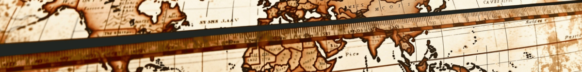
The astrolabe, a sophisticated instrument that has been pivotal in the field of navigation, is often regarded as one of the most significant technological advancements in the history of maritime exploration. Its intricate design and functionality allowed navigators to determine their position on Earth by measuring the angles between celestial bodies. This section delves into the definition and functionality of the astrolabe, its historical development, and the various variants used in navigation.
Definition and Functionality
The astrolabe is an ancient instrument that serves as a multifunctional tool for astronomers and navigators alike. At its core, it consists of a flat disk (the mater) with a rotating overlay (the rete) that features a map of the stars and other celestial objects. The user would align the rete with a particular star or celestial body and read the angle from the horizon on the scale marked on the astrolabe's edge. This measurement is crucial for celestial navigation, as it allows sailors to determine their latitude and, with additional calculations, their longitude.
Functionally, the astrolabe is designed to perform several critical tasks:
- Measuring the altitude of stars and planets above the horizon.
- Calculating time based on the position of celestial bodies.
- Determining direction (azimuth) towards celestial bodies.
- Assisting in the conversion of local solar time to universal time.
In the context of navigation, the astrolabe proved invaluable for sailors traversing unknown waters. By allowing them to measure celestial angles, it facilitated the navigation of vast oceans, guiding explorers to new lands and enabling the exchange of cultures and goods.
Historical Development of the Astrolabe
The origins of the astrolabe can be traced back to ancient Greece, around the 2nd century BCE. Early versions were primarily used for astronomical observations rather than navigation. However, by the Middle Ages, particularly in the Islamic Golden Age, the astrolabe underwent significant refinement and became a crucial tool for navigation and astronomy. Scholars such as Al-Battani and Al-Farghani contributed to the development of more accurate models, which included features allowing for better calculations of celestial distances and angles.
By the 15th century, the astrolabe had made its way to Europe, where it was further improved. The advent of the Age of Exploration prompted an increased demand for reliable navigation tools, and the astrolabe became a staple on European ships. Notable figures in maritime history, such as Christopher Columbus and Vasco da Gama, utilized the astrolabe during their voyages, relying on its precision to chart their courses across the Atlantic and Indian Oceans.
As navigation techniques evolved, the astrolabe began to lose prominence in favor of more advanced instruments, such as the sextant in the 18th century. Nevertheless, its contributions to the field of navigation and astronomy remain significant, marking a turning point in how humanity interacted with the cosmos.
Astrolabe Variants Used in Navigation
Throughout history, various astrolabe designs emerged, each tailored to specific applications and cultural contexts. Some of the most notable variants include:
- Planispheric Astrolabe: The most common type, used extensively in medieval Europe and the Islamic world. It features a map of the stars projected onto a flat surface, allowing users to take altitude measurements easily.
- Sextant: While technically not an astrolabe, the sextant evolved from astrolabe principles and became a primary instrument for celestial navigation, especially in the 18th century.
- Mariner's Astrolabe: A variation specifically designed for use at sea, featuring a larger size and more robust construction to withstand the maritime environment. It often included a sighting device to improve accuracy.
- Equatorial Astrolabe: This variant allowed for more straightforward observations of celestial bodies, particularly useful during the equinoxes when the sun crosses the celestial equator.
These variants illustrate the adaptability and enduring relevance of the astrolabe in navigating the complexities of both terrestrial and celestial landscapes. They paved the way for advancements in navigation technology, shaping the course of exploration and trade throughout history.
In conclusion, the astrolabe's intricate design and multifaceted functionality positioned it as a cornerstone of ancient navigation. Its historical evolution from a simple astronomical tool to a vital instrument for maritime exploration underscores its significance. The various astrolabe variants highlight the adaptability of this technology in meeting the diverse needs of navigators across different cultures and epochs. The astrolabe not only facilitated exploration but also fostered a deeper understanding of our place in the universe, making it an essential element in the narrative of human ingenuity and exploration.
The Astrolabe's Impact on Ancient Navigation Techniques
The astrolabe, an ancient instrument that revolutionized navigation, played a crucial role in the maritime practices of various cultures throughout history. In the context of Nicaragua, the astrolabe facilitated the exploration and trade routes of pre-Columbian societies and later European navigators. This section delves into the significant impact of the astrolabe on ancient navigation techniques, highlighting celestial navigation methods, case studies of astrolabe use in Nicaraguan waters, and its contributions to trade and exploration.
Celestial Navigation Methods
Celestial navigation is the art of using the positions of celestial bodies—such as the sun, moon, planets, and stars—to determine one's location on Earth. This method has been vital for sailors navigating vast oceans, especially before the advent of modern navigational tools. The astrolabe served as an essential instrument in this process, enabling navigators to measure the altitude of celestial bodies above the horizon.
One of the primary uses of the astrolabe was to determine latitude, which is crucial for maritime navigation. By measuring the angle of the sun at noon or the altitude of stars during the night, navigators could ascertain their position north or south of the equator. The astrolabe's ability to provide accurate measurements allowed sailors to traverse the open seas with greater confidence and precision.
In the context of Nicaragua, indigenous sailors likely employed celestial navigation long before the arrival of Europeans. Evidence suggests that the Miskito and Garifuna people, among others, used their knowledge of the stars and ocean currents to navigate the coastal waters. The astrolabe, once introduced, would have enhanced these existing practices, allowing for more precise navigation and exploration of the region's rich maritime resources.
Key celestial navigation techniques included:
- Solar Navigation: Using the sun's position at different times of the day to determine latitude.
- Stellar Navigation: Observing the North Star, or Polaris, which remains relatively fixed in the night sky, to establish direction in the northern hemisphere.
- Planetary Navigation: Using the movements of planets, particularly Venus and Jupiter, which were significant markers for certain cultures.
Case Studies: Astrolabe Use in Nicaraguan Waters
While the specific use of the astrolabe in Nicaragua is less documented than in other regions, historical accounts and archaeological evidence suggest that the instrument played a role in the maritime activities of both indigenous and European navigators. The arrival of Spanish explorers in the 16th century marked a significant turning point in Nicaraguan navigation, as they brought European navigational techniques and instruments, including the astrolabe.
One noteworthy case is that of the Spanish navigator Francisco Hernández de Córdoba, who is credited with the first European expedition to Nicaragua in 1524. During his voyage, Córdoba utilized the astrolabe to chart his course through the coastal waters, marking the beginning of a new era in Nicaraguan maritime exploration. The astrolabe allowed him to gather data on the latitude and longitude of various coastal landmarks, facilitating further exploration and settlement.
Moreover, the astrolabe's influence extended beyond mere navigation; it also affected the mapping of the region. As explorers like Córdoba charted their routes, they created maps that would later serve as vital tools for trade and colonization. The accuracy gained through the use of the astrolabe contributed to more reliable maps, which were essential for subsequent expeditions and the establishment of trade routes along the Central American coastline.
Another significant case is the use of the astrolabe by the British during their exploration of the Caribbean and Central America in the 17th century. British navigators, such as Sir Henry Morgan, utilized the astrolabe to navigate the waters around Nicaragua, particularly when engaging in trade and piracy. The instrument allowed them to gauge their position accurately, which was crucial in an era marked by competition for resources and territory.
Contributions to Trade and Exploration
The impact of the astrolabe on trade and exploration in Nicaragua is profound. As European powers sought to expand their influence and control over lucrative trade routes, the astrolabe became an indispensable tool for maritime expeditions. Its ability to provide accurate navigation helped facilitate the movement of goods, people, and ideas across the region.
Nicaragua's strategic location along the Central American isthmus made it a focal point for trade between the Atlantic and Pacific oceans. The use of the astrolabe by European traders allowed them to navigate these waters efficiently, leading to the establishment of trade networks that linked various ports and cities. For instance, the trade of cacao, gold, and other resources became more viable as navigators could accurately chart their courses and avoid dangerous waters.
Furthermore, the astrolabe's contribution to exploration cannot be overstated. It enabled sailors to venture into previously uncharted territories with greater confidence. The successful navigation of the San Juan River and the Caribbean Sea by explorers equipped with astrolabes opened new avenues for settlement and exploitation of the region's resources.
In addition to material wealth, the astrolabe facilitated cultural exchanges between indigenous populations and European settlers. As explorers and traders interacted with local communities, knowledge and techniques were shared, enriching both cultures. The astrolabe served as a bridge between different worlds, allowing for the blending of indigenous navigational practices with European methodologies.
In summary, the astrolabe significantly impacted ancient navigation techniques in Nicaragua, enhancing celestial navigation methods, providing critical case studies of its use in Nicaraguan waters, and contributing to the growth of trade and exploration in the region. Its introduction transformed the way navigators approached the sea, leading to more accurate and efficient maritime practices that would shape the history of Nicaragua and its place in global trade networks.