Mapping Belarus: A Journey Through its Geographical History
Belarus, a landlocked country in Eastern Europe, is often overlooked in discussions about geographical and historical significance. However, its rich tapestry of landscapes, rivers, and a unique climate plays a critical role in understanding not just the nation itself, but also its evolution through time. This article embarks on a journey to map Belarus, exploring its geographical history and the myriad factors that have shaped its identity over the centuries.
From ancient settlements to the modern use of Geographic Information Systems (GIS), the geographical narrative of Belarus is both complex and fascinating. The interplay between its natural resources and the influences of neighboring countries has led to significant territorial changes, impacting the lives of its inhabitants. By delving into these themes, we aim to provide a comprehensive overview of Belarus's geographical evolution and its importance in the broader context of European geography.
Geographical Overview of Belarus
Belarus, a landlocked country located in Eastern Europe, is often overshadowed by its more prominent neighbors, such as Russia to the east and Poland to the west. Despite its relatively modest size, Belarus boasts a unique geographical landscape that is both rich in resources and diverse in ecosystems. Understanding the geographical overview of Belarus involves examining its location and borders, its major rivers and lakes, and its climate and natural resources, each of which plays a crucial role in shaping the country's identity and development.
Location and Borders
Belarus is situated at the crossroads of Europe, bordered by Latvia to the north, Lithuania to the northwest, Poland to the west, Ukraine to the south, and Russia to the east. The total area of Belarus is approximately 207,600 square kilometers, which makes it one of the larger countries in Europe, although it is often considered relatively small when compared to its neighbors. The capital city, Minsk, is located in the central part of the country and serves as the political, economic, and cultural center.
The geographical coordinates of Belarus are approximately 53°N latitude and 28°E longitude. Its central location in Europe has historically made it a significant transit route for trade and cultural exchange, linking Western Europe with Eastern Europe and Russia. This centrality has influenced the historical development of Belarus, shaping its cultural and political landscape.
Belarus's borders are relatively straight, a characteristic that reflects the political decisions made during the Soviet era. The western border with Poland is marked by the Neman River, while the southern border with Ukraine and the eastern border with Russia are defined by more natural features, such as rivers and forests. The northern border with Latvia and Lithuania is characterized by a mix of lakes and forests, contributing to the overall biodiversity of the region.
Major Rivers and Lakes
The waterways of Belarus are among its most significant geographical features, playing a vital role in the country’s ecology and economy. The major rivers include the Dnieper, the Neman, and the Pripyat. The Dnieper River, one of the longest rivers in Europe, flows through the eastern part of the country and eventually leads to the Black Sea. This river has been crucial for transportation and trade throughout history, serving as a vital artery connecting Belarus with other regions.
The Neman River, flowing from Belarus into Lithuania, is another important waterway, known for its picturesque landscapes and rich biodiversity. The Pripyat River, which flows through southern Belarus, is significant for its ecological value, providing habitat for various species of flora and fauna. These rivers not only contribute to the natural beauty of Belarus but also provide resources for agriculture, fishing, and transport.
In addition to rivers, Belarus is home to numerous lakes, with the largest being Lake Narach. Covering an area of approximately 79.6 square kilometers, Lake Narach is a popular destination for both locals and tourists, known for its recreational opportunities, including fishing, boating, and swimming. The lakes of Belarus, often surrounded by dense forests, contribute to the country's scenic beauty and serve as crucial habitats for wildlife.
- Dnieper River: Major waterway connecting Belarus with the Black Sea.
- Neman River: Known for its biodiversity and scenic landscapes.
- Pripyat River: Ecologically significant river flowing through southern Belarus.
- Lake Narach: Largest lake in Belarus, popular for recreational activities.
Climate and Natural Resources
The climate of Belarus is classified as a humid continental climate, characterized by warm summers and cold winters. The average temperature in summer ranges from 20°C to 25°C, while winter temperatures can drop to -6°C to -8°C. The country experiences a moderate level of precipitation, with rainfall distributed fairly evenly throughout the year. Snow cover is common in winter, and the presence of forests and wetlands contributes to the overall humidity of the region.
Belarus's geographical features significantly influence its climate. The vast stretches of forests, which cover approximately 40% of the country, act as natural air conditioning, moderating temperatures and contributing to local weather patterns. These forests are home to a diverse range of flora and fauna, making Belarus one of the greenest countries in Europe.
In terms of natural resources, Belarus is rich in peat, which is significant for the agricultural sector, particularly in terms of soil fertility. The country is also endowed with deposits of potash, which plays a crucial role in the production of fertilizers. Additionally, the presence of various minerals, such as limestone and dolomite, supports the construction and manufacturing industries.
Belarus's natural resources, combined with its favorable climate, create a conducive environment for agriculture. The fertile soil in the lowland areas, particularly in the river valleys, supports the cultivation of grains, potatoes, and vegetables. The agricultural sector is a vital component of the Belarusian economy, providing employment and contributing to food security.
| Natural Resource | Importance |
|---|---|
| Peat | Essential for soil fertility and agriculture. |
| Potash | Crucial for fertilizer production. |
| Minerals (Limestone, Dolomite) | Supports construction and manufacturing industries. |
In conclusion, the geographical overview of Belarus provides insight into the country's natural environment, which is characterized by its strategic location, diverse waterways, and rich natural resources. These elements not only define the physical landscape of Belarus but also play a crucial role in its economic development and cultural identity. The interplay between geography and human activity in Belarus continues to evolve, reflecting the dynamic nature of this Eastern European nation.
Historical Development of Belarusian Geography
The geographical history of Belarus is a fascinating tapestry woven together by ancient human settlements, the influence of neighboring powers, and the dynamic territorial changes that have shaped the nation over centuries. As a landlocked country in Eastern Europe, Belarus boasts a rich historical narrative that reflects the interplay of culture, politics, and geography. This section delves into the evolution of Belarusian geography, exploring ancient settlements, the impact of neighboring countries, and the intricate territorial changes that have occurred throughout Belarus's history.
Ancient Settlements and Civilizations
Belarus has been inhabited for thousands of years, with archaeological evidence suggesting that the territory was home to various ancient cultures. The earliest known inhabitants were tribes such as the Balts and Slavs, who settled in the region around 2000 BC. These tribes engaged in agriculture, hunting, and trade, creating a foundation for future civilizations.
By the first millennium AD, the area that is now Belarus was influenced by significant cultural and political changes. The Slavic tribes began to consolidate, forming loose confederations that would lay the groundwork for later state formations. One of the notable early states was the Polotsk Principality, which emerged in the 9th century. Polotsk became a center of trade and culture, benefiting from its strategic location along trade routes connecting the Baltic and Black Seas.
As the Polotsk Principality expanded, it absorbed neighboring tribes and territories, influencing the geographical landscape of Belarus. The establishment of fortified settlements and trade routes contributed to the growth of urban centers, which became essential for the political and economic development of the region. The capital of the principality, Polotsk, was particularly significant, as it served as a cultural and religious hub, fostering the spread of Christianity in the region.
Throughout this period, the geography of Belarus was marked by its vast forests, rivers, and fertile plains, which not only provided resources for its inhabitants but also shaped the socio-economic dynamics of the region. The Dnieper, Western Dvina, and Neman rivers served as vital arteries for transport and trade, further enhancing the strategic importance of the territory.
Influence of Neighboring Countries
The geographical landscape of Belarus has been profoundly influenced by its neighbors throughout history. The proximity to powerful states such as Poland, Lithuania, and Russia has led to a complex interplay of cultural exchanges, territorial disputes, and political domination. In the 14th century, the Grand Duchy of Lithuania emerged as a dominant power in the region, incorporating Belarusian lands into its territory.
The Grand Duchy of Lithuania played a crucial role in shaping the identity of Belarus. The fusion of Lithuanian and Belarusian cultures fostered a unique blend of traditions, languages, and religions. The political landscape of the Grand Duchy also allowed for a degree of autonomy for the Belarusian people, leading to the development of a distinct Belarusian identity within a multi-ethnic state.
However, the influence of neighboring countries was not solely positive. The 16th century saw the Union of Lublin, which unified the Grand Duchy of Lithuania and the Kingdom of Poland into the Polish-Lithuanian Commonwealth. This union further complicated the political landscape, as it introduced new administrative structures and cultural influences that sometimes marginalized the Belarusian identity.
As the Commonwealth expanded, Belarusian territories faced pressures from both internal and external forces. The influence of Polish culture and language was significant, leading to tensions between the Polish-speaking elites and the Belarusian-speaking populace. This period marked a critical point in the historical development of Belarusian geography, as it navigated the challenges of cultural preservation amid external pressures.
Territorial Changes Through the Ages
The history of Belarus is characterized by a series of territorial changes that have had lasting impacts on its geographical landscape. The partitions of the Polish-Lithuanian Commonwealth in the late 18th century resulted in significant territorial losses for Belarus. Russia, Prussia, and Austria divided the region, leading to the incorporation of Belarus into the Russian Empire. This shift marked a new chapter in the geographical history of Belarus, as the region underwent extensive administrative and cultural changes under Russian rule.
During the 19th century, the geographical boundaries of Belarus continued to evolve, particularly with the rise of nationalist movements. The struggle for autonomy and self-determination was fueled by the desire to preserve the Belarusian language and culture amidst the pressures of Russification. The establishment of various cultural organizations during this period demonstrated a growing awareness of Belarusian identity, leading to a push for greater political representation.
The aftermath of World War I brought further territorial shifts, as Belarus briefly gained independence in 1918. However, this independence was short-lived, as the region was soon engulfed in the chaos of the Russian Civil War. By 1921, the Treaty of Riga partitioned Belarus between Poland and the Soviet Union, solidifying the divisions that would characterize Belarusian geography for decades.
Under Soviet rule, Belarus underwent significant administrative reorganization. The borders of the Belarusian SSR were established, and the region was transformed into an industrial hub. The emphasis on industrialization and collectivization altered the geographical landscape, as urban centers grew rapidly, and rural areas faced depopulation. The Soviet era also brought about environmental changes, as extensive agricultural practices led to alterations in the natural landscape.
The collapse of the Soviet Union in 1991 marked a turning point in the geographical history of Belarus. The country gained independence and redefined its territorial boundaries. This newfound independence allowed for a resurgence of national identity and cultural expression, as Belarus sought to establish itself on the global stage.
In the years following independence, Belarus has faced challenges related to its geographical positioning between East and West. The geopolitical landscape has continued to influence Belarusian territorial dynamics, particularly in relation to Russia and the European Union. The ongoing complexities of international relations, trade, and cultural exchanges have further shaped the geographical identity of Belarus in the contemporary era.
In conclusion, the historical development of Belarusian geography is a narrative of resilience and adaptation. From ancient settlements and civilizations to the profound influence of neighboring countries and territorial changes, the geographical landscape of Belarus reflects the enduring spirit of its people. This journey through time highlights the intricate connections between geography, culture, and history, shaping the Belarus we know today.
Mapping Techniques and Modern Geography
The field of geography has evolved significantly over the centuries, influenced by technological advancements, scientific discoveries, and societal needs. This section delves into the mapping techniques employed in Belarus, illustrating how traditional cartography has laid the groundwork for modern geographic practices, including Geographic Information Systems (GIS), and examining future trends that will further shape the understanding of Belarus' geography.
Traditional Cartography of Belarus
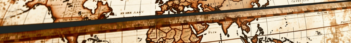
Traditional cartography in Belarus has roots that date back to ancient times, with early maps often reflecting the socio-political dynamics and territorial claims of various civilizations. The earliest known maps of the region were created by travelers and explorers who documented their journeys through handwritten notes and sketches. These maps were not only practical tools for navigation but also served as historical documents that captured the cultural and geographical landscape of Belarus.
During the Renaissance, cartography began to formalize as a discipline. The introduction of the printing press allowed for the mass production of maps, which increased their accessibility and utility. Notably, in the 16th century, the famous cartographer Gerardus Mercator included Belarus in his world maps, showcasing the region's significance in European geography. Subsequently, the 17th and 18th centuries saw the emergence of more detailed maps as the Grand Duchy of Lithuania and the Polish-Lithuanian Commonwealth became prominent powers in Eastern Europe.
Throughout the 19th and early 20th centuries, the mapping of Belarus underwent various transformations influenced by political changes, such as the partitions of Poland and the eventual incorporation of Belarus into the Soviet Union. Soviet-era cartography emphasized the portrayal of natural resources, industrial regions, and agricultural land, reflecting the state's economic priorities. Maps from this period often featured a standardized approach, using a uniform color scheme and symbols to represent different land uses.
In modern times, traditional cartographic techniques still hold value. Hand-drawn maps and artistic representations of Belarusian landscapes celebrate the country's cultural heritage and offer a unique perspective that digital maps cannot replicate. Local artists and historians continue to produce maps that highlight historical events, folklore, and significant cultural sites, preserving the essence of Belarusian identity through geography.
Geographic Information Systems (GIS)
The advent of Geographic Information Systems (GIS) has revolutionized the field of geography, providing powerful tools for data analysis and visualization. GIS combines cartography, statistical analysis, and database technology, enabling the manipulation and interpretation of spatial data in ways that traditional mapping techniques cannot achieve. In Belarus, GIS has become increasingly important for urban planning, environmental management, and infrastructure development.
One of the primary applications of GIS in Belarus is in urban planning. As cities expand and populations grow, it becomes crucial to analyze spatial data to make informed decisions regarding land use, transportation, and public services. GIS allows urban planners to visualize patterns, identify areas of need, and simulate the impact of proposed developments. For instance, in the capital city of Minsk, GIS has been employed to assess traffic patterns, identify congestion hotspots, and plan public transportation routes effectively.
In addition to urban planning, GIS plays a vital role in environmental management. Belarus is endowed with rich natural resources, including vast forests, rivers, and lakes, which require careful monitoring and preservation. GIS technology facilitates the assessment of environmental changes, such as deforestation, pollution, and habitat loss. By analyzing spatial data, environmental scientists can identify trends and develop strategies for sustainable resource management. For example, the Belarusian government has utilized GIS to monitor the health of its forests and implement conservation initiatives aimed at protecting biodiversity.
Moreover, GIS is crucial in disaster management and response. By mapping hazard-prone areas, such as flood zones or regions susceptible to industrial accidents, authorities can develop effective emergency response plans. GIS enables the integration of real-time data, allowing for timely responses to natural disasters and other emergencies, ultimately saving lives and minimizing damage.
As Belarus continues to embrace technological advancements, the use of GIS is expected to expand further. Educational institutions are increasingly incorporating GIS training into their curricula, equipping future generations with the skills needed to navigate a data-driven world. Additionally, the government and private sectors are investing in GIS infrastructure to enhance service delivery and improve decision-making processes.
Future Trends in Mapping and Geography
The future of mapping and geography in Belarus is poised for exciting developments, driven by rapid technological advancements and an increasing emphasis on data-driven decision-making. Several trends are expected to shape the landscape of geography and mapping in the coming years.
One significant trend is the rise of 3D mapping and visualization technologies. Traditional 2D maps are being supplemented by 3D representations, allowing for a more immersive understanding of geographic features and urban environments. In Belarus, this trend has the potential to enhance tourism by providing visitors with virtual tours of historical sites, natural landscapes, and urban areas. By utilizing 3D mapping, tourists can experience Belarus from their own homes, promoting interest and encouraging future visits.
Another trend is the integration of big data with geographic analysis. The proliferation of digital devices has led to an explosion of data generation, and this data can be harnessed to gain insights into human behavior, environmental changes, and economic patterns. In Belarus, big data analytics can inform public policy, improve public health initiatives, and optimize transportation systems. By combining big data with GIS, policymakers can make more informed decisions that positively impact citizens’ lives.
Additionally, the use of mobile mapping applications is becoming increasingly prevalent. With the widespread adoption of smartphones, individuals can access geographic information on the go. In Belarus, mobile apps that provide real-time traffic updates, public transportation schedules, and navigation assistance are becoming essential tools for residents and visitors alike. These applications empower users to make informed decisions about their travel routes and explore the country more efficiently.
Furthermore, community engagement in mapping initiatives is gaining traction. Crowdsourced mapping projects allow citizens to contribute local knowledge and data, enriching geographic databases. In Belarus, community-driven mapping efforts can help document cultural heritage, identify areas in need of development, and improve disaster preparedness. By involving local communities in mapping processes, a more accurate and inclusive understanding of the geography of Belarus can be achieved.
Finally, the emphasis on sustainability and climate change adaptation is expected to shape future mapping practices. As Belarus confronts environmental challenges, mapping technologies will play a crucial role in assessing vulnerabilities and developing strategies for resilience. Geographic analysis can inform land-use planning, identify areas at risk of flooding or erosion, and support conservation efforts aimed at preserving biodiversity.
In summary, the evolution of mapping techniques in Belarus reflects the dynamic interplay between tradition and modernity. Traditional cartography laid the foundation for contemporary geographic practices, while GIS has revolutionized data analysis and visualization. As the field continues to evolve, embracing new technologies and methodologies, Belarus will undoubtedly benefit from a more comprehensive understanding of its geography, ultimately enhancing the quality of life for its citizens.